BBB bikeboard app
BBB Bikeboard app
Geschichte lesen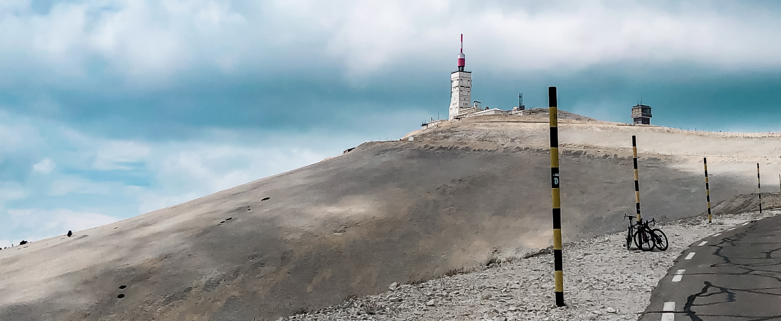
The Mont Ventoux, the bald mountain, is a climb that has been on my to-bike list for a long time. The year before I started cycling I visited the iconic mountain with the car and watched how my brother climbed to the top. In the years thereafter I took on some climbs myself such as the Alpe d’Huez, Col du Galibier, Col de la Croix-de-Fer, Col de la Madeleine, Col de la Colombière, the Stelvio Pass, and the Gavia Pass. All very tough but fantastic at the same time. Kind of unplanned, the Mont Ventoux was added to this year’s list.
When more countries turned yellow in June and traveling was allowed we had the idea to go to Mallorca for training. To go there was a little tougher than expected so we decided to go to France instead. Our campsite happened to be close to Mont Ventoux and in exactly that specific week the Mont Ventoux stage of the Tour de France would be happening. The perfect excuse to climb the Mont Ventoux and watch the queen stage of the Tour live!
Some practical information: The Mont Ventoux can be climbed from three sides. The top of the climb is at 1900 m altitude. If you cycle the Mont Ventoux from the South side, you cycle from Bedoin, according to most the ‘real’ side since the climb is the hardest. From bottom to top you climb 1610 m of elevation in 21,5 km with an average steepness of 7,5%.
During our first bike day towards the Mont Ventoux, we started in Bedoin. In the first few kilometers, you are asking yourself whether the climb has started. The first 6 kilometers are very steady with an average steepness gradient of 4%. This is fine, we are talking to each other and looking around at the beautiful surroundings. Suddenly you are surrounded by a forest. In Saint-Esteve you take the hairpin bend to the left and before you know it the climb has started. The forest, also named ‘hell’, lasts 8 km, straight roads no less than 9%. Due to the lack of hairpin bends that I am used to from other climbs, there is no possibility to give your legs some rest. Be smart and arrange the right cassette so that you can tackle this climb. It’s not short and steep like in the Ardennes but will feel a lot longer than you wished for.
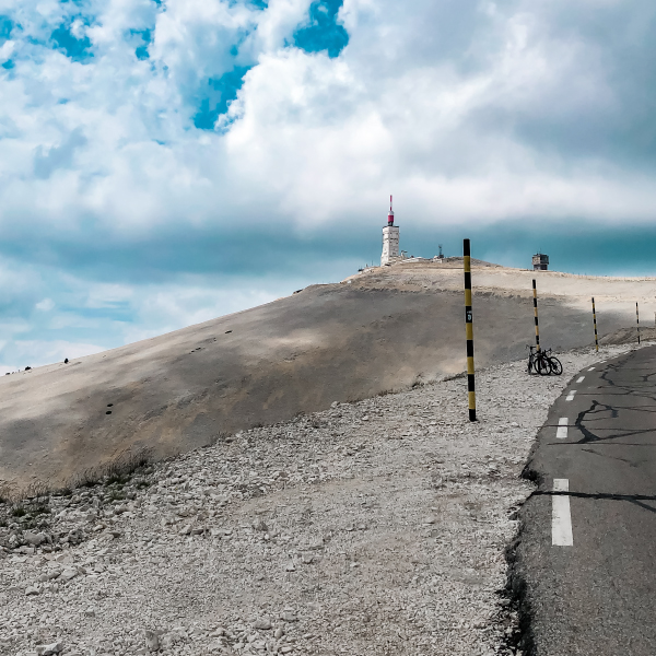
When arriving at Chalet Reynard the tension can be removed from the legs for a short while and you can finally cycle normally without feeling like you have square wheels. After the chalet, you begin the last 6 km of the climb. This felt more like my area. During the last 5 km, you cycle with an average steepness of 6% to 8% which felt pretty good. From here on, the mountain is ‘bald’ and the views are breathtaking. However, the wind does not make it easy. Also mentally, this part is pretty tough because you can see the top but because of the hairpin bends, it takes longer than expected to reach it.
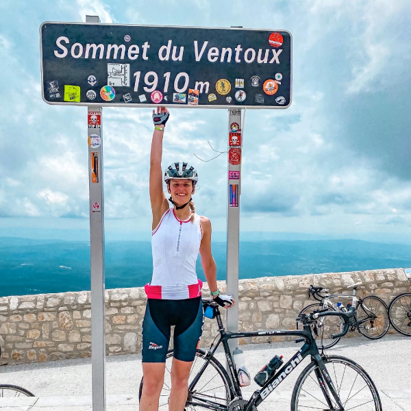
After taking a photo at the top, obviously, with the Mont Ventoux sign, it’s time to descend (tip, take a packable wind jacket or gilet with you as it can get cold while descending). We decided to descend towards Sault so we could already have a look around to see where we would park the next day to watch the Tour. The road was wide, smooth tarmac and due to a lack of hairpin bends, you have a great overview of what’s coming. A fantastic descent to attack your speed record.
On day two we climbed via Sault, the East side of the Mont Ventoux, and the side where the road cyclists would come from first. Sault is a little higher than Bedoin at 765 m in altitude. From Sault, the climb is the longest, 25,9 km with an average steepness of 4,7%. This side is seen as the ‘easiest’ side. The first 20 km never goes above 6%. After that, you reach Chalet Reynard and the last 6 km are the same as when you cycle from Bedoin.
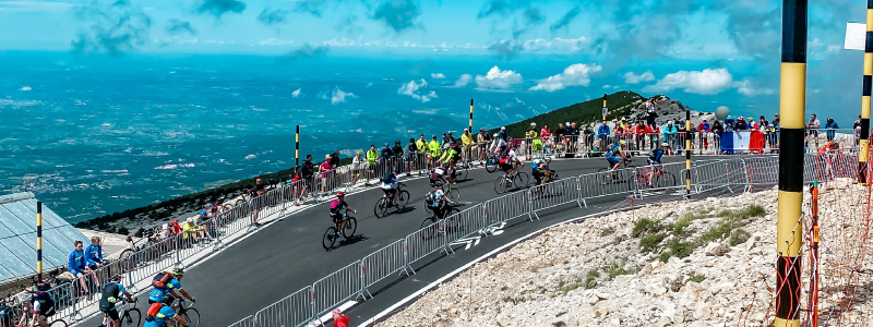
The most fun thing about this day was the atmosphere. An enormous amount of people are cycling and walking up the mountain to watch the pro cyclists pass. This stage would go up from Sault to the top of the Ventoux, descend via the Northern side towards Malaucène and ascend again via Bedoin.
From Sault, it’s really nice to climb the mountain. Since it isn’t very steep, you can keep a good cadence and still have some sprockets left for the last kilometers. Cause let’s be honest, even though you feel like you are flying throught the first 20 km, the last 5 are still tough to climb. After the climb, we descended about 3 km to wait for the pro cyclists to arrive on the bald section that they would pass twice.
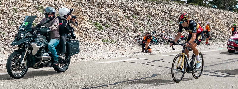
And so we waited, which isn’t boring at all. There are so many bike crazy people and the publicity caravan will make it feel like a true party. When the first helicopters and motorcycles came into view, the jitters started to come, the first pro cyclists were coming. The upside of waiting for the cyclists to pass on a climb is that they are not going so fast and the peloton is broken up which gives you the opportunity to really take a good look and encourage the riders on. After Mark Cavendish and the bus had passed coming from the ‘easy’ side, we didn’t have to wait very long for Wout van Aert to come up a second time from the Bedoin side by himself. Nothing but respect for the riders who came up the mountain once more from the ‘hard’ side. It’s always nice to experience the emotion up close.
The atmosphere of the Tour is something you need to have experienced, there’s a big chance you’ll want to go again.
P.s. Curious which other routes I cycled during my time in the Ardèche? Check out my Komoot!


Lumen und Lux – ist das bei Fahrradlampen das Gleiche?
Geschichte lesen